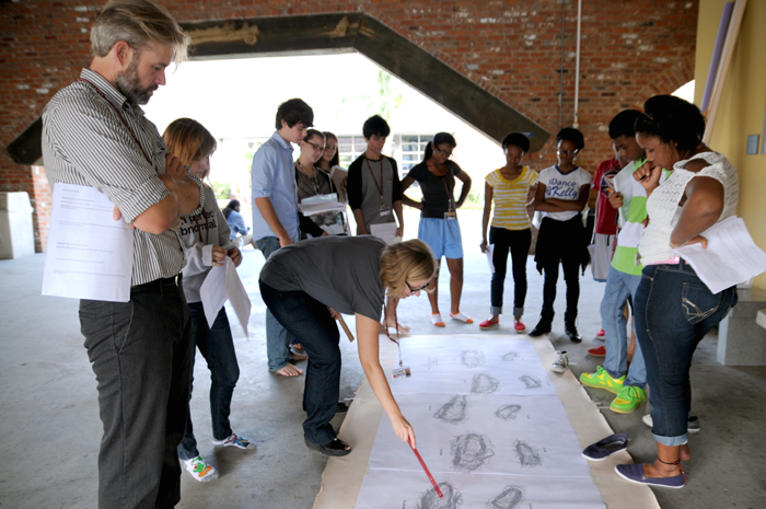
One day last fall, students arrived to a topographical map taped to the floor of the breezeway. Their charge: to discover what the oblong-lined shapes meant using the measurement systems, geology, biology, scientific data collection and historical research skills they had been learning.
Using observation, most students believed the marks to be footprints. But what more could they deduce? They tried walking in the footsteps but found two modern day teenagers couldn’t walk together without bumping the other off course. What did this say about the two beings that made the prints and their relationship? Moreover, what did the distance between the marks say about possible height and speed? What did the depth say about the geology and environment?
At different stations, students measured their own foot length and gait when walking and running, used mathematical formulas to convert gait to height, then applied that knowledge to the graph markings. Their deduction: the markings were made by one adult walking slowly with a child, demonstrating a caring relationship.
Found in Tanzania in 1978 by anthropologist Mary Leaky, the Lateoli footprints became the center of a lesson across the fields of science, math and humanities, engaging students in the excitement of discovery.
Initially printed in The NOCCA Institute’s July 2013 Aspirations newsletter